
Mount Tai: the sacred mountain of the East泰山
Mount Tai, Taishan, in Shandong province is China’s most famous mountain. Emperors sacrificed to heaven here, Confucius climbed it, and today millions of Chinese climb a stone stairway of almost 8,000 steps every year, many of them at night to see the sunrise from the top.
You don’t have to walk every step, though. Buses and cable cars take you to just below the summit. Below you will find a map that suggests a way up and a way down for your age and plans, a sunrise planner and our photos from the climb in April 2024.
In short
- 1Height: 1,545 m, the eastern of the five sacred mountains
- 2All on foot: 9.5 km, 7,863 steps, 4 to 6 hours up
- 3Without hiking: Bus and cable car to just below the summit
- 4Entrance: 115 ¥ (≈ $16.99), valid 3 days
- 5Getting there: High-speed train to Tai’an, Beijing–Shanghai line
Mount Tai in numbers
- 1,545 m
- Jade Emperor Peak 玉皇顶
- 7,863
- steps from the Red Gate
- 1,633
- of them on the Eighteen Bends
- 9.5 km
- footpath to the summit
- 1987
- UNESCO World Heritage, natural and cultural
- 6
- emperors who sacrificed to heaven here
Which way up, which way down?
Four paths lead up Mount Tai, plus two bus lines and two cable cars. Choose who is going and what you plan: the map shows the way up in green and the way down in blue, with walking time and cost on the right. You can also pick both ways yourself. Up and down on the map is real height.
Who is going?
What is the plan?
Your pace
Our recommendation
Half and half: take the bus to the Middle Gate, then walk the Eighteen Bends, the finest and steepest part. Take the cable car down to save your knees. See the temple and inscriptions lower down the next day on the same ticket.
- bus: Bus Tianwaicun ↔ Middle Gate30 min · 35 ¥
- on foot: Footpath over the Eighteen Bends2 h
The best part on foot, the long lower half by bus. The buses run until 9 pm according to the scenic area, and many people take one of the last and climb the Eighteen Bends at night.
At the top
From the South Gate along the Heavenly Street to the summit, 30 min
- on foot: Walk top station ↔ South Gate10 min
- cable car: Middle Gate cable car10 min · 100 ¥
- bus: Bus Tianwaicun ↔ Middle Gate30 min · 35 ¥
Easy on the knees. After sunrise the cable car queue is long, people who have breakfast first usually wait less.
- Walking uphill
- 2 h 30 min
- Walking downhill
- 35 min
- Bus and cable car
- 1 h 10 min
- Cost per person
- 285 ¥
- ≈ $42.11 · Entrance 115 ¥ plus rides
Stations on the map
Tap a point on the map or a name in the list.
The mountain’s great temple in the centre of Tai’an. Every imperial journey to the summit started here. According to the scenic area, your mountain ticket also covers it.
Stone archway at the foot of the mountain, today on a traffic island. You can see the summit from here.
The reopened old path in the east. Fewer people, lots of forest, its own entrance with a visitor centre.
Mountain bus terminal west of the Red Gate. The buses climb a hairpin road to the Middle Gate of Heaven in a little over 30 minutes.
Start of the classic footpath. Right at the beginning stands the First Gate of Heaven 一天门 with the stone “天下奇观”, “the greatest wonder under heaven”.
Western entrance in the “peach blossom valley”. Quieter than the east, with peach blossom in spring.
Small nunnery by the path with a stream beside it. A good first break.
A few minutes off the path: the Diamond Sutra carved into a flat slab of rock, over a thousand characters, many half a metre tall, from the 6th century.
The name says that even horses had to turn back here. The path gets steeper from here.
Lower station of the western cable car. The buses from Taohuayu end here.
Halfway. The footpath, the buses from Tianwaicun and the East Imperial Road meet here. Lower cable car station, shops, toilets.
Stone bridge over a waterfall, best after rain.
The First Emperor, Qin Shihuang, is said to have sheltered from the rain under a pine here and given it the official title Wudafu in thanks.
Stone archway in the middle of the Eighteen Bends. The steepest part comes after it.
Whoever walks through is, by its name, almost an immortal. From here the steps are steepest and the South Gate of Heaven is in sight.
The cable cars arrive on the ridge by the South Gate of Heaven, a few minutes’ walk away.
The red gate at the end of the Eighteen Bends, built in 1264. Walk through it and you are at the top.
The classic sunrise spot, with Gongbei Rock 拱北石 jutting out towards the northeast.
Shopping street on the ridge with restaurants, hotels and coat rental.
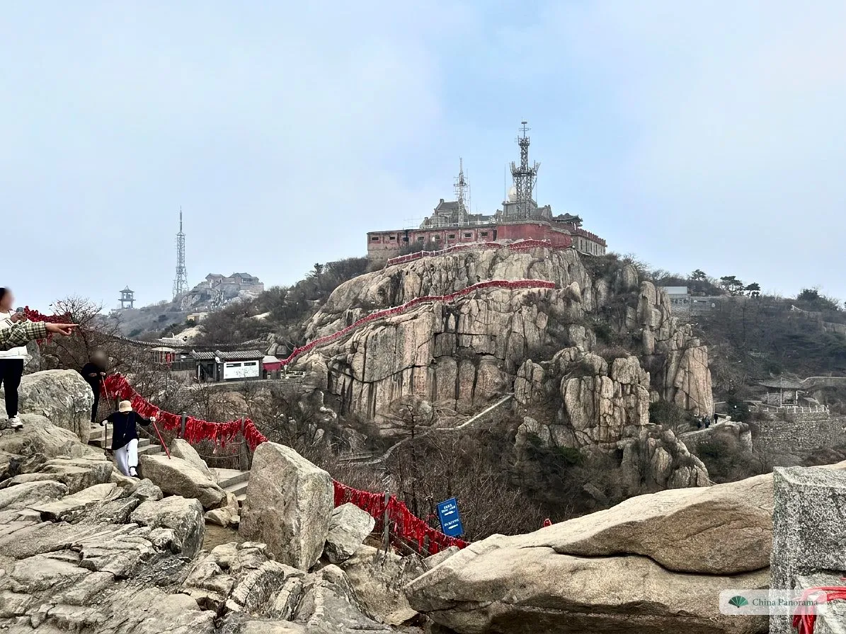
Temple of the goddess Bixia Yuanjun, to whom many Chinese pray for children and health. Hence the many red ribbons.
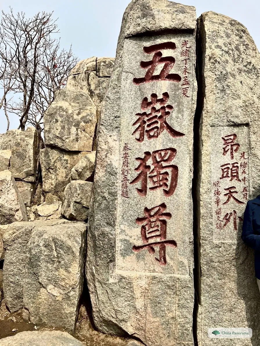
The mountain’s best-known photo spot, carved in 1907. It is also on the back of the 5-yuan note.
The highest point with the Jade Emperor Temple. In its courtyard lies the summit rock with the stone “泰山极顶 1545米”.
Walking times are typical values at a normal pace with short breaks. Add the waits for bus and cable car, often over an hour on public holidays. Prices according to the scenic area as of 2024: bus 35 ¥, cable car 100 ¥, each per ride.
Our recommendation by age
The suggestions from the map as a table, for a day trip and for the sunrise.
With children
Day trip
↑ Bus and cable car
↓ Cable car and bus
Ride up and down and walk only at the top, from the South Gate to the summit, just over 30 minutes. Children up to 1.4 m enter the park free, on the cable car children from 1.2 m pay the full fare.
Sunrise
↑ Bus and cable car · stay at the top
↓ Cable car and bus
Don’t climb at night with children: ride up in the afternoon, sleep in a hotel at the top and walk 15 minutes to the viewpoint before sunrise. Take warm jackets, it is about 8 degrees colder at the top than in town.
18 to 35
Day trip
↑ All the way on foot from the Red Gate
↓ Eighteen Bends on foot, then bus
Walk all the way from the Red Gate: 9.5 km and 7,863 steps, 4 to 6 hours depending on breaks. Start early, the paths fill up from 9 am. Take the bus down from the Middle Gate and your legs will still work the next day.
Sunrise
↑ All the way on foot from the Red Gate
↓ Cable car and bus
The Chinese classic: set off from the Red Gate between 10 pm and midnight, walk slowly, wait at the top. A headlamp and a warm jacket are a must, coats are rented out at the top. Use the planner below for your start time.
35 to 58
Day trip
↑ Bus to halfway, then the Eighteen Bends
↓ Cable car and bus
Half and half: take the bus to the Middle Gate, then walk the Eighteen Bends, the finest and steepest part. Take the cable car down to save your knees. See the temple and inscriptions lower down the next day on the same ticket.
Sunrise
↑ Bus to halfway, then the Eighteen Bends · stay at the top
↓ Cable car to halfway, then on foot to the Red Gate
Bus up in the afternoon, walk the Eighteen Bends in the evening light, sleep at the top. After sunrise take the cable car to halfway and walk the lower part, with the Sutra Valley as a detour.
Over 60 or saving your knees
Day trip
↑ Bus and cable car
↓ Cable car and bus
Bus and cable car both ways, then a gentle walk to the summit and back. Go on a weekday, on public holidays the queues last hours. According to the scenic area’s price list, people aged 60 and over enter free and pay half for bus and cable car, ask at the counter with your passport.
Sunrise
↑ Bus and cable car · stay at the top
↓ Cable car and bus
Ride up in the afternoon and stay the night at the top. From the hotel the sunrise is only a few minutes away, without any night hike.
The four entrances
All entrances use the same ticket. The scenic area gave these hours for October 2024, and they change with the season. At night only the Red Gate remains.
| Entrance | Entry | Then |
|---|---|---|
| Red Gate 红门 | 5:00–23:00 | Footpath, the classic climb and the night route |
| Tianwaicun 天外村 | 6:00–21:00 | Buses to the Middle Gate of Heaven |
| Taohuayu 桃花峪 | 6:00–17:30 | Buses to the Taohuayuan cable car, in the west |
| East Imperial Road 东御道 | 8:00–16:00 | Footpath in the east, about 5 km and 4,000-odd steps to the Middle Gate |
The classic path, station by station
Our photos of 1 and 2 April 2024, from the bottom up. In early April the trees are still bare, but the peach trees blossom lower down and it is not hot.
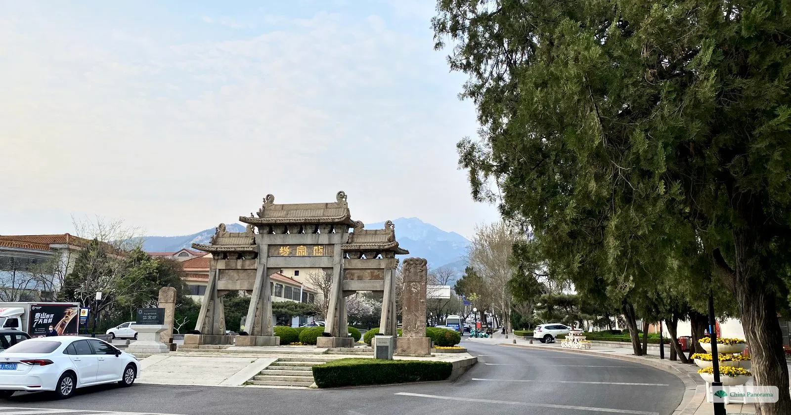
1 · 岱宗坊
Daizong Archway, at the foot of the mountain
The stone archway now stands on a traffic island at the edge of Tai’an. On clear days the summit is visible behind it. You can walk here from the Dai Temple in town, but many people take a taxi straight to the Red Gate.
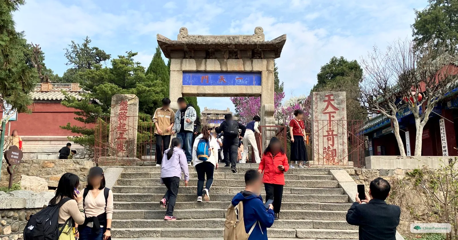
2 · 一天门
First Gate of Heaven, the start at the Red Gate
This is where the stairway begins. On the right the stone “天下奇观”, the greatest wonder under heaven. Just behind it an archway inscribed “孔子登临处”, where Confucius is said to have started his climb. We set off here at 8:37 am on 2 April 2024.
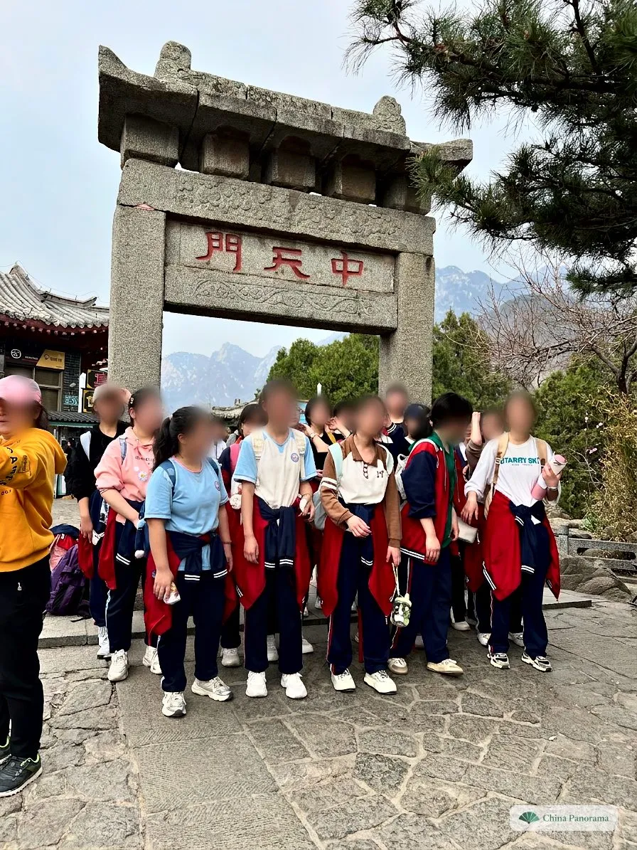
3 · 中天门
Middle Gate of Heaven, halfway at 847 m
The buses from Tianwaicun arrive here, the cable car starts here and there are shops and toilets. Many school classes take their group photo here. If you are tired you can ride from here and miss nothing important except the Eighteen Bends.
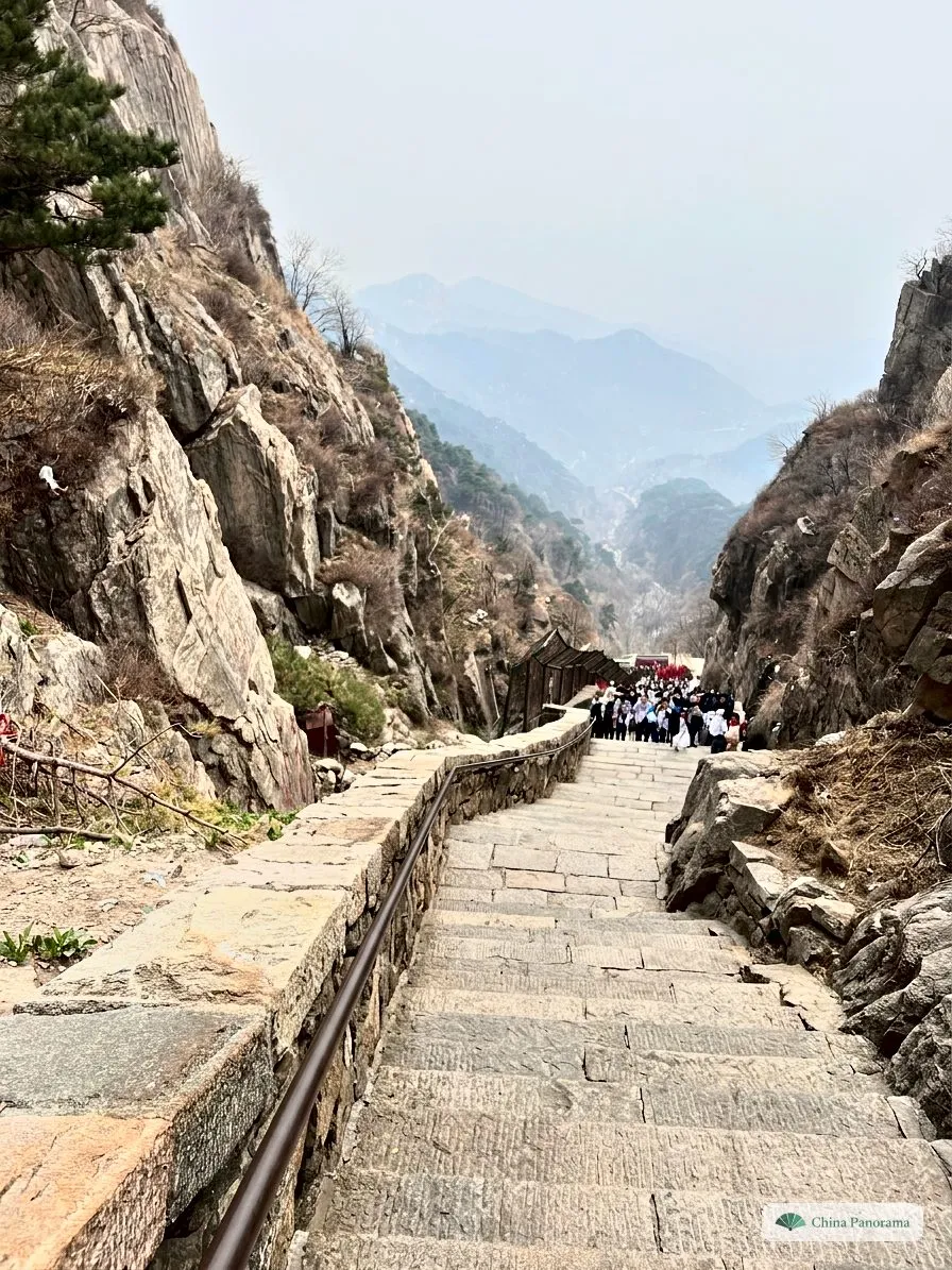
4 · 十八盘
Into the gorge: the start of the Eighteen Bends
After the Middle Gate the path runs almost level for a while, then the stairway heads into the gorge between two rock walls. The ridge is already up there in the haze. A saying counts the sections: “Slow eighteen, neither fast nor slow another eighteen, steep eighteen.”
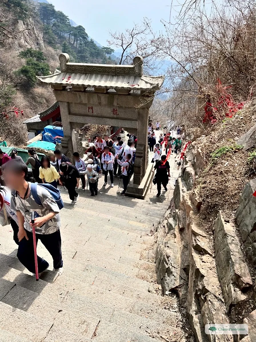
5 · 龙门坊
Dragon Gate, in the middle of the bends
Walking through the Dragon Gate you leap the threshold like the carp of the legend. From here the steps get higher and narrower. The walking sticks everyone carries are sold at every stall lower down.
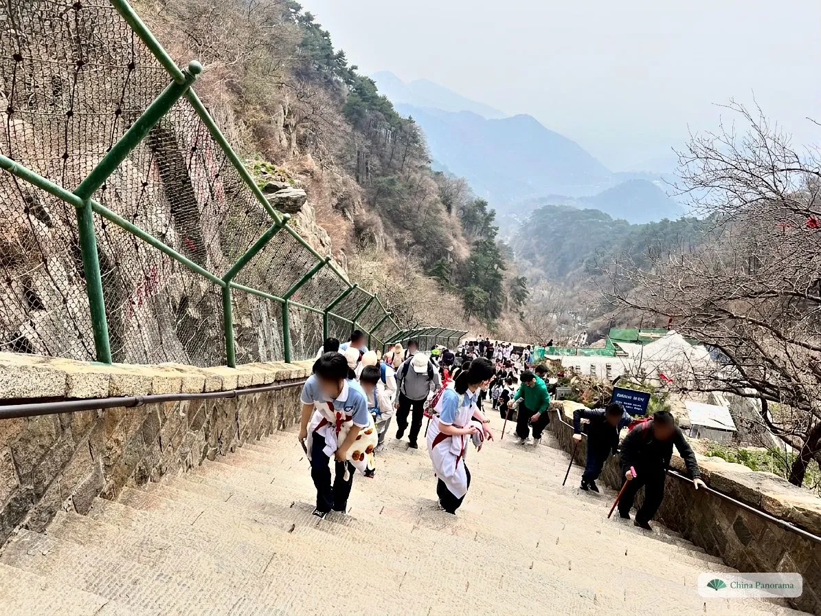
6 · 紧十八
The steep eighteen: the hardest part
The Eighteen Bends have 1,633 steps. People climb bent forward, many with one hand on the rail. Step to the side for breaks, on public holidays the crowd backs up here.
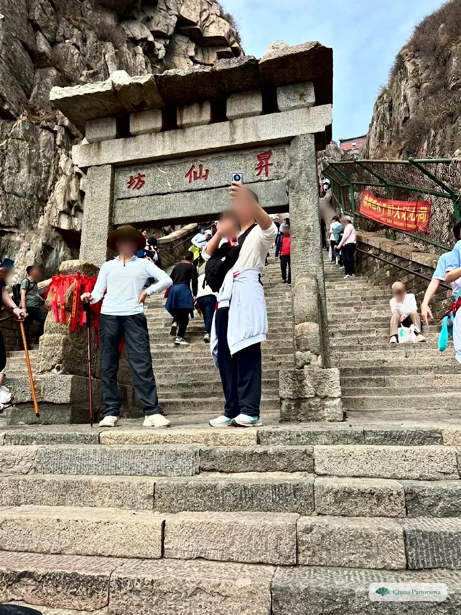
7 · 升仙坊
Gate of Ascending to Immortality
The name promises that whoever walks through rises to the immortals. The last steps up to the South Gate are the steepest of the whole path.
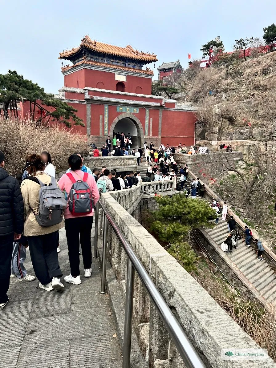
8 · 南天门
South Gate of Heaven at 1,460 m
The red gatehouse of 1264 sits in the saddle between two peaks. On the right the last steps of the Eighteen Bends come up. What the plaque and the two couplet boards say is in the tap-the-photo section below.
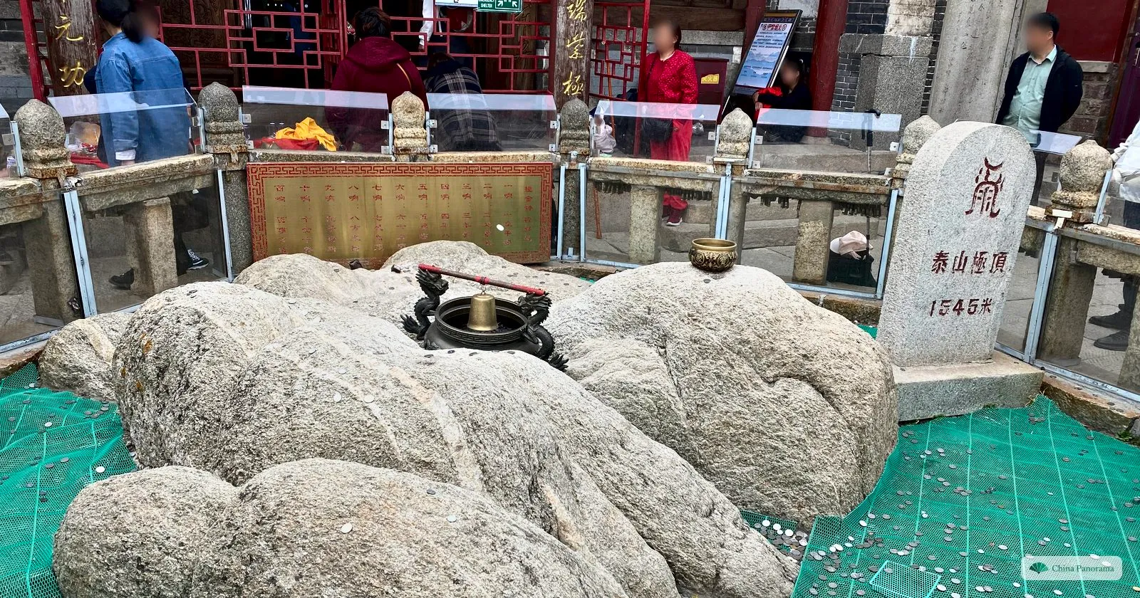
9 · 泰山极顶
The summit: 1,545 m
In the courtyard of the Jade Emperor Temple lies the highest rock, fenced in and covered in coins. The stone beside it reads “泰山极顶 1545米”, highest point of Taishan, 1,545 metres. We were at the top at 12:49, just over four hours after setting off, with breaks and plenty of photos.
Sunrise: when do I have to leave?
For many people in China, the sunrise on Mount Tai is the reason to climb. The sun rises over the plain to the east, on good days over a sea of clouds. Pick a date and your pace, and the planner tells you when to set off from where.
Sunrise on the summit
6:46
Beijing time
Be at the viewpoint by 6:16, 30 minutes early to find a spot
Sunset that day: 17:02
Red Gate, all on foot
5 h 10 min on foot, with short breaks
Entry until 11 pm according to the scenic area
Set off
1:06
Middle Gate, after the last bus
2 h 40 min on foot, with short breaks
Buses from Tianwaicun until 9 pm, then you wait in the dark at the top
Set off
3:36
Hotel on the summit ridge
15 min on foot, with short breaks
Eleven hotels at the top, book early for public holidays
Set off
6:01
Worked out for the horizon seen from 1,545 m. Haze over the plain often delays the visible sunrise by a few minutes.
How cold is it at the top?
On the summit about 2 °C
Roughly 8 degrees colder than in town, and wind makes it feel colder still. Add the time you wait standing still.
Sunrise on the summit, on the 15th of each month in 2027
| Month | Sunrise | Start at the Red Gate, normal pace |
|---|---|---|
| January | 7:16 | 1:36 |
| February | 6:54 | 1:14 |
| March | 6:19 | 0:39 |
| April | 5:34 | 23:54 |
| May | 4:59 | 23:19 |
| June | 4:47 | 23:07 |
| July | 4:58 | 23:18 |
| August | 5:23 | 23:43 |
| September | 5:47 | 0:07 |
| October | 6:11 | 0:31 |
| November | 6:42 | 1:02 |
| December | 7:09 | 1:29 |
Beijing time. The best spot is Sun Viewing Peak 日观峰 with Gongbei Rock 拱北石, a good 15 minutes from the South Gate. It fills up early.
Reading the inscriptions: two photos to tap
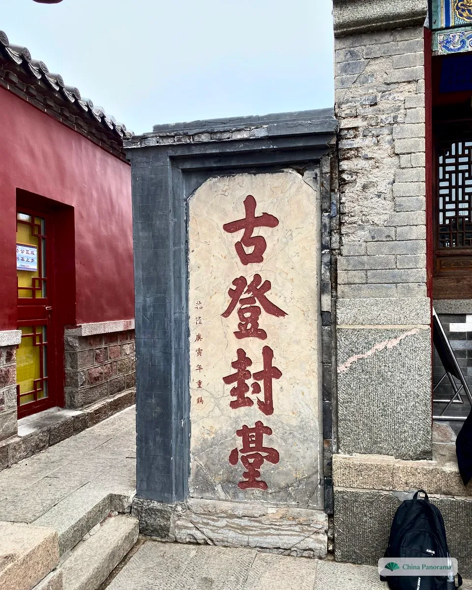
Rocks, gates and boards on Mount Tai carry well over a thousand inscriptions. Here are two of the best known. Tap the numbers to read what they say.
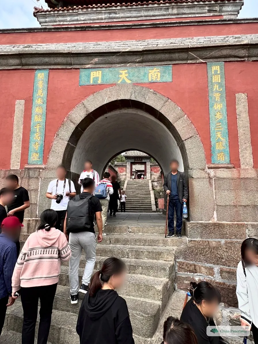
1South Gate of Heaven
南天門 nán tiān mén · the plaque, read right to left
Old plaques read right to left: 南 south, 天 heaven, 門 gate. The gate was built in 1264 at the top of the Eighteen Bends. Standing here, you have the steep steps behind you.
Tap a number on the photo, or a name in the list.
Why Mount Tai is sacred
Ancient China had five sacred mountains, 五岳 wǔ yuè, one for each direction and one for the centre. Mount Tai is the mountain of the East. The sun rises in the east, where by old belief all life begins. That made it the first of the five, even though it is not the highest.
| Mountain | Direction | Province | Height |
|---|---|---|---|
| 泰山 Tài Shān | East | Shandong | 1,545 m |
| 华山 Huà Shān | West | Shaanxi | 2,155 m · the highest |
| 衡山 Héng Shān | South | Hunan | 1,300 m |
| 恒山 Héng Shān | North | Shanxi | 2,016 m |
| 嵩山 Sōng Shān | Centre | Henan | 1,512 m |
Sacrifices to heaven
An emperor’s greatest rite was 封禅 fēngshàn: a sacrifice to heaven on the summit and one to the earth on a small hill below. Only a ruler who had united the empire and brought peace dared to hold it. Six emperors did:
- 219 BCQin Shihuang, the First Emperor
- 110 BCEmperor Wu of Han
- AD 56Emperor Guangwu of Han
- 666Emperor Gaozong of Tang, with Empress Wu
- 725Emperor Xuanzong of Tang
- 1008Emperor Zhenzong of Song, the last one
Confucius and Du Fu
Mencius wrote: “Confucius climbed the Eastern Hill and the state of Lu looked small. He climbed Mount Tai and the world looked small.” The poet Du Fu saw the mountain from below in 736 and wrote the poem “Gazing at the Mountain” 望岳. Every schoolchild in China knows its last two lines:
会当凌绝顶,一览众山小。
huì dāng líng jué dǐng, yì lǎn zhòng shān xiǎo
“One day I will stand on the very top and see how small all the other mountains are.”
The goddess and the guardian stone
Most people who climb today visit the goddess Bixia Yuanjun in the Bixia Temple at the top. She is seen as the mountain’s daughter and helps with wishes for children and with illness. The red ribbons on the railings are wishes. And all over China small stones at street corners carry the inscription “泰山石敢当”: the stone from Mount Tai dares to stop evil.
Tickets, prices and getting there
Prices
- Entrance, valid 3 days, including the Dai Temple
- 115 ¥ ≈ $16.99
- Pupils, students up to bachelor level, ages 6 to 18
- 57 ¥ ≈ $8.42
- Bus from Tianwaicun or Taohuayu, per ride
- 35 ¥ ≈ $5.17
- Cable car Middle Gate or Taohuayuan, per ride
- 100 ¥ ≈ $14.77
- Houshiwu cable car in the north, closed in winter
- 20 ¥ ≈ $2.95
Free according to the scenic area’s price list: children up to 6 or up to 1.4 m, and people aged 60 and over. From 60, half fares for bus and cable car. Whether this applies to foreign passports, ask at the counter, we could not confirm it.
Buying a ticket with a passport
- Tickets are in your name, one per person. According to the scenic area they are sold up to 7 days ahead in the WeChat account “泰山景区”, where you choose the passport as your ID.
- Since 2025, according to China Daily, there is a ticketing platform for overseas visitors run with Trip.com, plus express counters with passport scanners.
- At the gate, foreign visitors use the staffed lane, not the turnstiles. Don’t leave your passport at the hotel.
- Buy bus and cable car tickets at the stations or in the same WeChat account.
Getting to Tai’an
Tai’an is on the Beijing–Shanghai high-speed line, and the fast trains stop at Tai’an station 泰安站. Slower trains stop at Taishan station 泰山站, closer to the mountain. From either, take a taxi to the Red Gate or Tianwaicun, both on the northern edge of town. If you drive: parking at the Red Gate is scarce.
More for the trip: Beijing, Shanghai, best time to visit, public holidays in China, mountains, lakes and rivers at a glance.
Packing list for Mount Tai
Pack light: water and food are sold at every turn, just dearer. Your ticks are saved on this device.
0 of 7 done
Five mistakes many people make
1Going on a public holiday
During Golden Week and around 1 May people stand shoulder to shoulder on the Eighteen Bends and wait hours for bus and cable car. Come on a weekday.
2No warm jacket at night
It is about 8 degrees colder at the top than in town, plus wind. After the climb you are sweaty and wait an hour. Take a jacket even in summer.
3Forcing the whole climb
If you don’t hike regularly you will feel the 7,863 steps for two days. Bus to halfway and then the Eighteen Bends is the better plan for most people.
4Ignoring the forecast
In haze or cloud there is no sunrise to see. Check the forecast the evening before and keep a spare day if in doubt, the ticket is valid for three days.
5Booking late
Hotels at the top and by the Red Gate fill up fast and cost more on holidays and weekends. Book early if you want to sleep at the top.
True or false?
1Taishan is the highest of the five sacred mountains.
False
At 1,545 m it is only the third highest. Huashan and the northern Hengshan rise above 2,000 m. Its rank comes from its place in the east, where the sun rises, and from the emperors who sacrificed here.
2You need hiking boots and experience to climb it.
False
The whole main path is a stone stairway with rails, shops and toilets. It is still hard work, because of the number of steps, not the technique.
3The ticket is valid for several days.
True
According to the scenic area it is valid for three days from the first entry. You can climb at night, sleep in town and see the Dai Temple the next day.
4You can ride the cable car up for sunrise at night.
False
According to the scenic area the cable cars start between 6 and 7:30 am depending on the season, after sunrise. To see the sunrise, walk up at night or sleep at the top.
5Confucius climbed Taishan.
True
Mencius records it: “Confucius climbed Mount Tai, and the world looked small.” At the First Gate of Heaven an archway inscribed “where Confucius climbed” recalls it.
6You almost always see the sunrise.
False
Haze, cloud and fog often hide it, especially in summer. Check the forecast the evening before. When the summit sits above a cloud layer, the sea of clouds 云海 is the best thing the mountain has to offer.
FAQ
How long does it take to climb Mount Tai?
On foot from the Red Gate to the summit allow 4 to 6 hours, depending on your pace and breaks: 9.5 km and 7,863 steps. We needed just over four hours with plenty of photo stops. By bus and cable car you can be at the top in under an hour, plus queues.
Can I visit Mount Tai without hiking?
Yes. Take the bus from Tianwaicun to the Middle Gate of Heaven and the cable car to the South Gate. At the top you only walk the ridge to the summit, about 30 minutes each way, with some steps.
How much does Mount Tai cost?
Entrance is 115 yuan, valid for 3 days from the first entry according to the scenic area. The bus to the Middle Gate costs 35 yuan and the cable car 100 yuan, each one way. Bus and cable car up and down add up to 385 yuan per person.
When is the best time to climb Mount Tai?
April, May, September and October are mild. Avoid the Golden Week at the beginning of October and the May Day holiday, when the paths and queues are packed. In winter the steps can be icy and some lines close. For the sunrise, check the forecast the evening before.
How do I get to Mount Tai?
High-speed trains stop at Tai’an station on the Beijing–Shanghai line. From there take a taxi to the Red Gate or Tianwaicun, both on the northern edge of the city. Qufu, the home of Confucius, is the next stop south and works well as a second day.
Can I stay overnight on the summit?
Yes. According to the scenic area there are eleven hotels at the top. They are simple and expensive, and full on public holidays. In exchange the sunrise is only a few minutes away.
Is Mount Tai suitable for children?
By bus and cable car, yes. The ridge walk at the top is short. Children up to 1.4 m enter free. A full climb on foot is for older children who walk a lot, and a night climb is not for children.
Sources and status
Prices, gate hours, the length and steps of the path come from the Taishan administration (2021 and 2024). They can change with the season, check the WeChat account “泰山景区” before you go. Walking times are typical values and our own time. We work out the sunrise with the NOAA method and a horizon lowered for 1,545 m.
- Taishan administration: Golden Week 2024 press conference, with gate hours, bus and cable car fares, length and steps of the path (Chinese)
- Taishan administration: services and fees, with concessions and seasonal cable car hours (Chinese, 2021)
- China Daily: New overseas ticketing platform (2025)
- China Daily: Express counters with passport scanners for foreign visitors (2025)
- UNESCO World Heritage: Mount Taishan
- Wikipedia: Mount Tai
- Wikipedia: 五岳, the five sacred mountains, with heights (Chinese)
- Chinanews: The landscapes on the yuan notes, Taishan on the 5-yuan note (Chinese)
Changelog (1)
- 2026-11-09Page created, with our own photos of 1 and 2 April 2024, a route map with a recommendation by age, a sunrise planner and two inscriptions to tap.